ANCIENT CITY OF KONEURGENCH
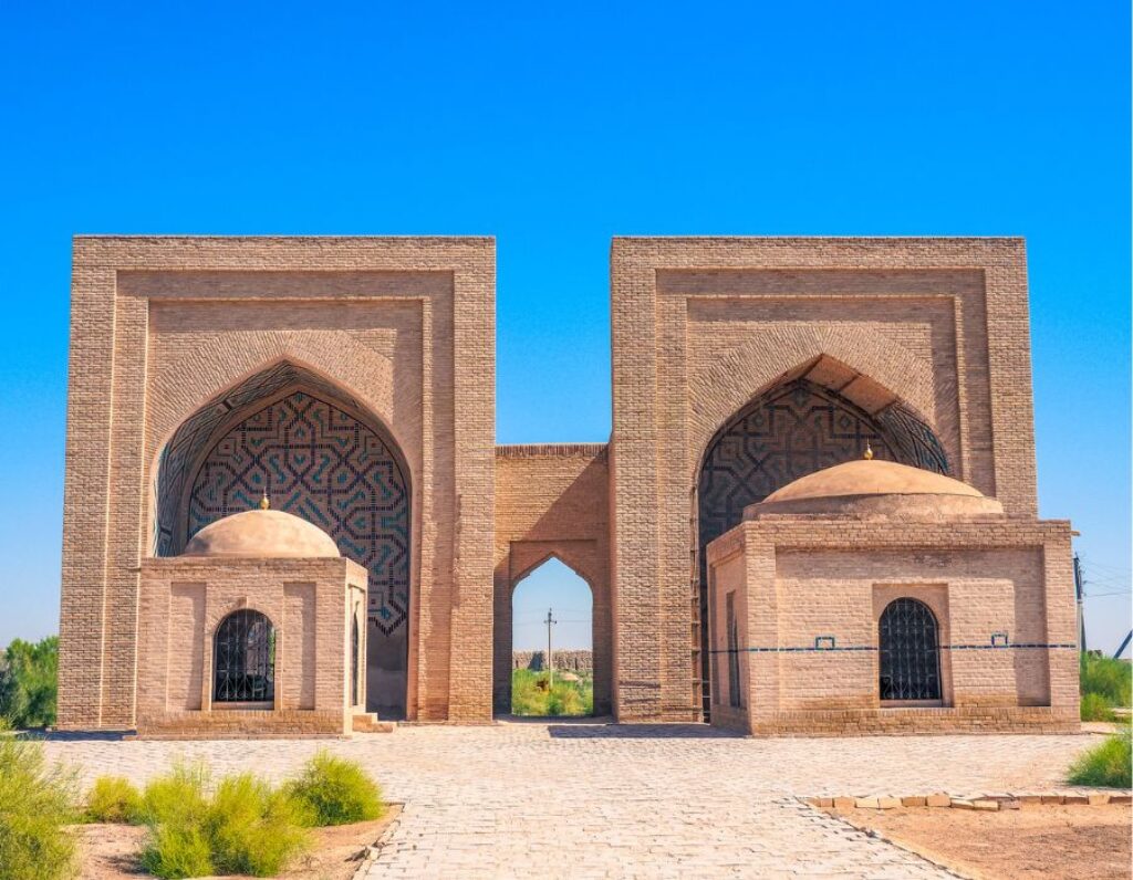
Koneurgench, or Old Urgench, is a city with a population of 37 thousand people, on the outskirts of which there is a historical and cultural museum-reserve, which is included in the UNESCO World Heritage List. Koneurgench was located near the old bed of the Amu Darya River, and was considered the largest city of the Great Silk Road. The remains and ruins of the city date back to the 5th-2nd centuries BC. The city is also mentioned in the holy books of Zoroastrian culture under the name Urwa.
On the territory of the settlement there are a number of attractions, of which the oldest building is of particular importance – the Kirkmolla fortress, on the territory of which the Academy of Sultan Mamun ibn Mamun was built in the 11th century. It is also worth noting the location of many ancient mosques, minarets, caravanserais and fortresses located in this place. Nowadays, the most famous architectural monument located here is the mausoleum of Old Urgench and the tallest brick minaret in Central Asia – Kutlug-Timur, built in the 14th century. To the north of the site is a large medieval cemetery of 360 saints. According to legend, 360 saints who died as martyrs during the conquests of Genghis Khan are buried here.
ANCIENT CITY OF MERV

In the southeastern part of the state of Turkmenistan is the oldest city in Central Asia. It stands on the banks of the Murgab River, not far from the city of Mary. Today, Ancient Merv is a ruin, which is a World Heritage Site for all humanity. During the era of the Margiana civilization, the Merv oasis was already inhabited. This suggests that it existed for another 3-2 thousand years BC. In our era, the city became one of the main centers of Parthia. At that time, its area was 60 square meters. Km. After the Arabs conquered Central Asia in the 7th century, the city became a springboard for conquest expeditions to the east and north.
Over time, Merv turned into a book center for Arabs. This happened thanks to the ten libraries that were located here. During the reign of the Samanid dynasty, Merv truly flourished. This happened in the 12th century when Sultan Sanjar turned it into the capital of the Seljuks. The buildings inside the city were amazing – they were more majestic than the buildings of Baghdad and Constantinople. But already in 1221 the Mongols mercilessly destroyed the beautiful city. The Timurids attempted to revive Merv, but it was never able to achieve its former greatness.
PARTHIAN FORTRESSES OF NISA
Nisa is an ancient city, which is located near the settlement of Bagir, 18 kilometers from Ashgabat. At the moment, only majestic ruins remain of the city. The Parthians founded the village in the 3rd century BC. For a long period, the place served as the residence of the Arsacid dynasty and, at the same time, the capital of all Parthia. After the Sassanids came to power, the city was devastated, but the Middle Ages revived it, making it a trading center on the Silk Road. From the 12th century, the city came under the rule of the new Anushteginid dynasty and remained their possession until the Mongol invasion in 1220.
Since the 16th century, the city has been steadily declining in development, and by the 18th century, it was a ruin that still adorns the desert. On the territory of Old Nisa, there are now ruins of several buildings – the Square House, which in ancient times served as the treasury of the kings, and the statue of Rodogune, which is now kept in the Main Museum of Turkmenistan. Also, in that place, there was a Round Temple, which most likely served the ancient peoples as a temple of the sun. Nowadays, the Ruins are listed as a UNESCO World Heritage Site.
NARYN-KALA FORTRESS

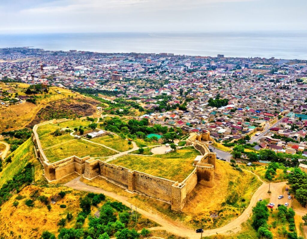
Naryn-Kala is the famous ancient Derbent fortress, which turned the city into a “Closed Gate”. Its double walls, which descended to the Caspian Sea itself, made it possible to completely control the narrow coastal passage from the sea to the south, to Persia. The fortress was protected on three sides by steep mountain cliffs, and towers were built within the walls at a distance of about 25 m from each other. Naryn-Kala, together with the Dag-Bary wall, today remains one of the largest protective structures in the world and is included in the UNESCO World Heritage List.
The monumental structure of Dag-Bara, 42 km long, stretched through groves and hills and went into the mountains; it was impossible to get around it. The territory of the fortress was about 4.5 hectares. Inside, there were structures necessary to withstand a siege: in particular, a large reservoir for drinking water (6th century), mostly going underground. In the event of a siege, the defenders could have enough water for six months. True, the fortress was never considered “unconquered”: it did fall several times under the pressure of the besiegers. The western gate of Naryn-kal was called the “Gate of Shame”: dishonest military leaders escaped from the fortress through them when luck turned away from the defenders.
The Russians took the fortress in 1796 during the war with Persia. In addition, you can find some even more interesting and older ruins here. For example, the remains of a 4th-century Christian church, which was then converted into a Zoroastrian sanctuary and then into a mosque. This church is considered the first Christian temple in the country. The ruins of the Khan’s palace from the 18th century are also worth visiting.
Also, here are the Khan’s baths and the Khan’s office of the 18th century, which is occupied today by the Museum of Ancient Derbent. And also a guardhouse building built in 1828, where an art gallery with an exhibition dedicated to the history of the city is open. From the building materials that went to Naryn-Kala and Dag-Bary, seven Cheops pyramids can be built. The fortress is considered an absolute must-see also because of the stunning view of the city and surrounding area that opens from here.
POMPEII

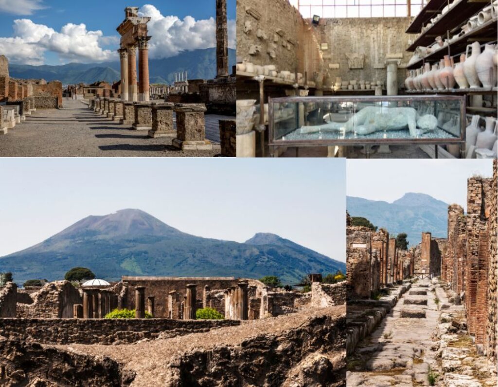
This city, near modern Naples, achieved posthumous fame after the most famous volcanic eruption in history. The terrible natural disaster lasted for 24 hours. The force of the elements was such that volcanic ash reached Egypt and Syria. For more than one and a half thousand years, the sad place was avoided. And in the 18th century, archaeologists began excavations and discovered that under layers of frozen ash a huge monument of the life and culture of the Roman Empire had been preserved. Pagan temples, forums with arcades, theaters, and residential buildings were excavated almost in their original form.
Coloured frescoes can be seen on the walls of buildings, and numerous household items have been preserved inside residential buildings. During its lifetime, Pompeii was a prosperous city and left its descendants with many monuments of Roman art and culture. By the way, the images on Pompeian frescoes clearly reflect the frivolous morals of those times: many of their subjects are openly erotic. The easiest way to get to the city, which has long been turned into a giant open-air museum, is from Naples or Sorrento. An entrance ticket will cost adults approximately 11 euros.
SUNKEN CITY OF KEKOVA
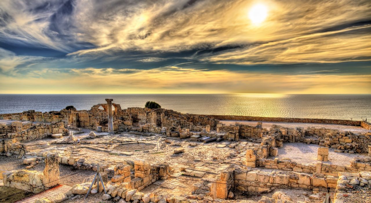
The sunken city of Kekova is a real paradise for archaeologists; so many archaeological remains have accumulated here that even over the past centuries, they have not had time to collect them all. A story similar to the mythical Atlantis happened to this city – as a result of tectonic movements, the earth moved, the Western Taurus mountains rose, and several cities went underwater.
People fled from here, taking only the most necessary things, which is why there is such a rich ancient layer of archaeological finds. The sunken city of Kekova is located near the city of Demre Cape. The road to it winds like a serpentine right above the sea. The local bay is filled with various boats and yachts. It is better to choose a yacht with a glass bottom to see the city underwater in all its glory. Diving here is strictly prohibited.
DEHISTAN
Dehistan is an ancient city located in the Misrian Plain. Now, this is a deserted place with many architectural and historical monuments, but once, it was a prosperous city with a developed infrastructure. The earliest traces of human activity in Dagestan date back to the 3rd century BC. These lands were inhabited by the Sakas, Ephalites, Massagetae, and Dahi, and it was they who created large settlements in this area. The most outstanding monument in this area is the ancient city of Misrian, which appeared in the 8th century AD and existed until the 15th century. Here, you can see the well-preserved Shir-Kabir mausoleum, two minarets 25 meters high, and many dilapidated buildings with beautiful patterns covered with glaze.
The area of the city was more than 200 hectares and was surrounded by rings of walls, which have now been partially excavated. In different parts of the fortress walls, several gates indicated the direction of the caravan routes from the city. This proves that the city played an important role in trade. Now, this area is a desert with a huge number of historical and archaeological monuments, most of which are hidden under the sand.


